Defining the scope with Table A
Before we start, we need the exact list of Table A items requested by your lender or title company. These are specific additions to the base survey. Bring the exact requirements from all reviewing parties so we can price and schedule the fieldwork accurately. Each added Table A item costs $150 to $600. Because these additions are priced individually, get the specific list from the lender before budgeting the project.
Locating site features and elevations
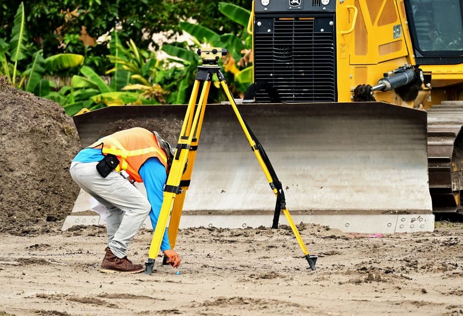
Our fieldwork covers all improvements, utilities, and encroachments on the site. We use monument-recovery tools to establish the boundary framework, then locate the site features in relation to those lines. If the client requests elevation items from Table A, we bring in digital levels to handle the measurements. We account for this digital-level work in the per-item cost.
Permits and seasonal conditions
Melrose applies the Massachusetts 10th Edition Building Code, which is based on the 2021 International Building and Residential Codes with state amendments. Even if a project is not regulated by the building code, Melrose zoning requires permits for fences and retaining walls. Check these local requirements before planning boundary improvements based on the survey. Finally, Melrose sits in a cool climate with cold winters (climate zone 5A). Frozen ground impacts how we recover monuments, so keep the season in mind when scheduling site work.
A Look at the Work
Examples of the work involved, start to finish.


What to Expect
-
Tell Us What You Need
A two-minute call is enough for us to understand the job and what it'll take.
-
We Take a Look
We come out, look at the space, and confirm exactly what the job involves.
-
Know the Price First
We put the work, the timeline, and the number on paper — take your time with it.
In practice, on a job like this:
- Locating all improvements, utilities, and encroachments on the site
- Adding the specific Table A items the lender or title company requires
What It Typically Costs
These are planning ranges. Nothing is final until it is in writing.
$2000–$4500
Questions Melrose Customers Ask
Price tracks the work, not the lot size alone. A clean platted lot with good corners is quick; a parcel with missing monuments, conflicting deeds, heavy tree cover, or a metes-and-bounds description takes far more research and field time. We quote after we see the deed and the record, so the number is real.
Usually yes, and often the permit requires it. Building to an assumed line is how encroachment problems start — a fence a foot over the line can cloud a future sale. A current boundary survey shows exactly where you can build and keeps the improvement on your own ground.
It's marking the site so the contractor builds in the right place — offset stakes for the foundation, grade stakes for elevations, and layout for utilities, all set from the engineered plans. It's done in stages as the job progresses, which is why it's usually quoted per visit rather than as one flat fee.
A boundary survey with improvements locates visible features and the easements shown in the record — utility lines, drainage, access, and any structures near the lines. A full ALTA goes further. If a recorded easement doesn't show on your deed, the title research is where it turns up, which is one reason the record work matters.
Land survey costs vary based on property type and complexity. A residential boundary survey on a platted lot typically ranges from $500 to $1,200, while surveys for acreage or unplatted parcels can cost $1,200 to $4,000. Commercial ALTA/NSPS surveys range from $2,000 to $8,000. Factors like terrain, property size, and required details (e.g., easements, encroachments) influence pricing.
Surveying property yourself is not recommended. Land surveying requires specialized equipment, knowledge of legal boundaries, and adherence to state regulations. Only licensed surveyors can produce legally binding surveys. Attempting DIY surveys may lead to inaccuracies, legal disputes, or issues with property transactions.
To find a reliable surveyor, verify their state license and check for experience with similar projects. Ask for references, review their portfolio, and confirm they carry professional liability insurance. Look for surveyors familiar with local land records and regulations. Avoid unlicensed providers or those offering unusually low prices.
A Few More Questions
No. A phone's GPS is accurate to several feet at best and isn't tied to your deed or the corner monuments, so the lines those apps draw are approximate and carry no legal weight. Survey-grade GNSS fixes a point to the centimeter against a reference network — a different instrument for a different job.
The property address and, if you have them, a copy of your deed, any prior survey, and your title commitment. Access to walk the property helps, and if there's a specific reason for the survey — a fence, a sale, a building permit — telling us up front lets us scope it right the first time.
Where We Work
We work across Melrose, MA. Call (781) 590-6899 to confirm coverage for your address.