What gets staked
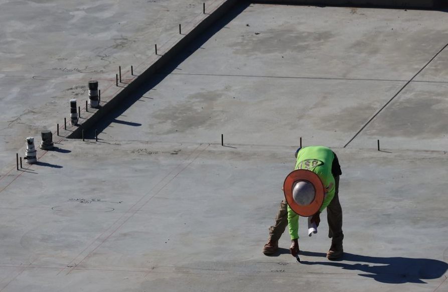
We stake utility lines and the finished grade. We transfer the elevation points from the approved site and grading plans to the ground. We also provide a cut-and-fill sheet so the crew builds to the right grade, knowing exactly how much dirt to remove or add. Marks inevitably get disturbed by heavy equipment during early work, so we re-stake as phases progress to keep the layout accurate before concrete gets poured.
Equipment and precision
We work strictly from the approved site and grading plans to stake the layout. We use digital levels for setting and checking grade. Precise grading ensures water drains away from the structure, which is critical in Melrose where winter freeze-thaw cycles easily damage waterlogged foundations and buried pipes.
Staking costs
We charge $400 to $1200 per utility or curb-line staking, per run. Re-staking as phases progress or marks get disturbed adds to the total, but checking the layout is always cheaper than tearing out a freshly poured slab that was set to the wrong elevation.
What to Expect
-
Tell Us What You Need
A two-minute call is enough for us to understand the job and what it'll take.
-
We Take a Look
We come out, look at the space, and confirm exactly what the job involves.
-
Know the Price First
We put the work, the timeline, and the number on paper — take your time with it.
In practice, on a job like this:
- Loading the engineered design coordinates into the field controller
- Setting offset stakes for the building corners so the forms have a reference
What It Typically Costs
These are planning ranges. Nothing is final until it is in writing.
$500–$1500
Questions Melrose Customers Ask
To find a reliable surveyor, verify their state license and check for experience with similar projects. Ask for references, review their portfolio, and confirm they carry professional liability insurance. Look for surveyors familiar with local land records and regulations. Avoid unlicensed providers or those offering unusually low prices.
The cheapest type is typically a residential boundary survey on a platted lot, costing $500 to $1,200. However, costs depend on property size, terrain, and required details. More complex surveys, like those for acreage or commercial properties, are significantly more expensive.
A residential survey usually takes 1-2 weeks, depending on property complexity, access to records, and surveyor workload. Delays can occur if original markers are missing or if there are boundary disputes. Always confirm timelines with your surveyor upfront.
A land survey includes researching deeds and prior surveys, locating boundary markers, measuring the property, resolving boundary conflicts, and setting new markers if needed. It also identifies improvements, easements, and encroachments. The surveyor drafts a sealed plat or map detailing these findings.
Free property surveys are rare. Most require professional expertise and equipment, incurring costs. Some municipalities may offer basic records, but these are not substitutes for a legal survey. Always hire a licensed surveyor for accurate, legally binding results.
A boundary survey focuses on defining property lines and corners. Other types include ALTA/NSPS surveys for commercial properties, topographic surveys for elevation details, and construction staking for building projects. Each serves specific purposes and varies in complexity and cost.
If your survey has errors, contact the surveyor immediately to request corrections. Licensed surveyors are obligated to fix mistakes. If they refuse, escalate to their licensing board or seek legal advice. Always review the survey thoroughly before accepting it.
A Few More Questions
It's a form a licensed surveyor completes documenting your building's elevation relative to the base flood elevation. You'll need one to buy or reduce flood insurance in a mapped flood zone, or to support a Letter of Map Amendment if you believe your structure was mapped into a floodplain by mistake.
Yes. Where corners are missing we set stamped iron rods or caps carrying the surveyor's license number, and we flag them so you can find them. The markers are part of the record — moving or destroying them is both a practical problem and, in most states, against the law.
No. A phone's GPS is accurate to several feet at best and isn't tied to your deed or the corner monuments, so the lines those apps draw are approximate and carry no legal weight. Survey-grade GNSS fixes a point to the centimeter against a reference network — a different instrument for a different job.
The property address and, if you have them, a copy of your deed, any prior survey, and your title commitment. Access to walk the property helps, and if there's a specific reason for the survey — a fence, a sale, a building permit — telling us up front lets us scope it right the first time.
Price tracks the work, not the lot size alone. A clean platted lot with good corners is quick; a parcel with missing monuments, conflicting deeds, heavy tree cover, or a metes-and-bounds description takes far more research and field time. We quote after we see the deed and the record, so the number is real.
Where We Work
We work across Melrose, MA. Call (781) 590-6899 to confirm coverage for your address.